A dam changes a lake ecosystem by replacing moving water with standing water. Everything downstream of that single change follows from it: the current slows, sediment and nutrients drop out and stay behind, the water layers into warm and cold bands, and fish can no longer move between the water they spawn in and the water they feed in.
None of that happens all at once. A dam is a slow transformation, and it changes shape with the dam’s design, its age, how operators manage its levels, and what the whole watershed sends downstream. This guide walks through what actually shifts, why it happens, and how you can see it yourself on your next trip to the water.
Table of Contents
- 1What Happens When a Dam Blocks a River?
- 2The four parts of a dammed system
- 3How Dams Change Water Flow and Lake Level
- 4Why Sediment and Nutrients Accumulate Behind Dams
- 5How the Light, Temperature, and Oxygen Balance Changes
- 6What stratification does to fish and water quality
- 7What Happens to Fish, Plants, and Other Lake Life
- 8Habitat and populations shift
- 9Why the Downstream Ecosystem Is Also Affected
- 10Which Changes Come From the Dam and Which Come From People?
- 11How to Observe Dam Impacts at a Lake
- 12Start with the operating record
- 13Look at the shoreline and the waterline
- 14Read the water at the outlet
- 15Watch the plants and the plankton
- 16Use the data that already exists
- 17Keep a safe distance from the structure
- 18Frequently Asked Questions
- 19Do dams always make a lake ecosystem worse?
- 20Why can dams cause algae to grow more often?
- 21How does a dam affect fish migration?
- 22Does water released from a dam have a different temperature?
- 23Why can’t you swim near a dam?
- 24What happens to sediment behind a dam?
- 25What to Look For First at a Dammed Lake
What Happens When a Dam Blocks a River?
Before the dam, there was a river. Rivers are transport systems. Water, gravel, silt, organic matter and drifting organisms all move continuously in one direction, usually toward the sea.
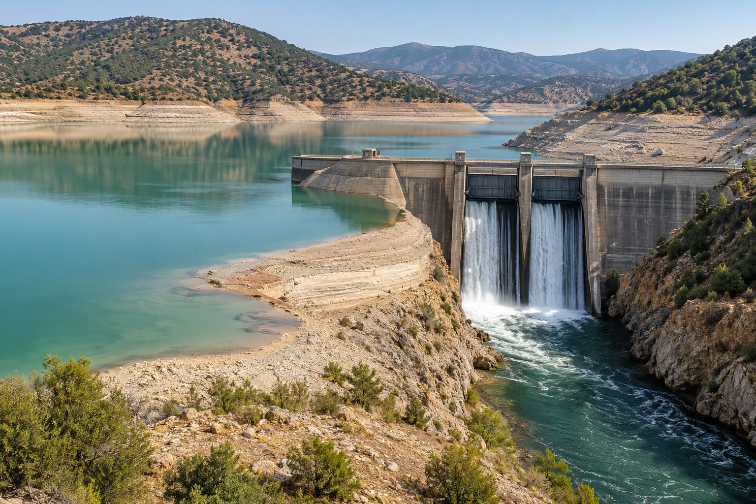
A dam stops that transport. The water that used to pass through in days now sits in a basin for months or years, and the river below becomes a narrow strip of moving water called tailwater. Everything around the basin, from the flooded valley walls to the farms and towns uphill, drains into that new lake. The dam becomes the narrowest point of an entire watershed.
The four parts of a dammed system
The reservoir is the impounded water behind the dam. What you call a lake is usually this. It is not the same thing as a natural lake, because its shape, depth and water level are set by water storage decisions rather than by geology alone.
The dam itself is the barrier. Depending on how it was built, it may be a concrete gravity structure, an earth-fill embankment or a concrete arch, and each behaves differently for fish, sediment and safety.
Outlet structures include the low-level gates, the spillway and the penstocks. Where the water is pulled from, and how deep that intake sits, decides the temperature and sediment load of the release.
The tailwater below the dam is where the consequences of release decisions become visible. It is often only a few hundred metres long before the river spreads out again.
How Dams Change Water Flow and Lake Level
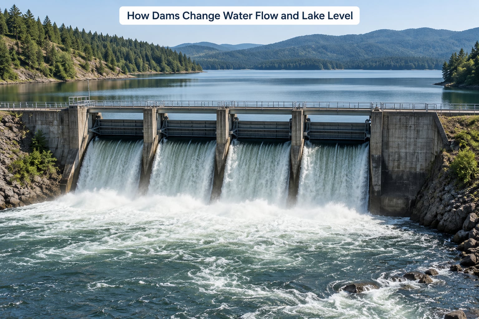
A river experiences a natural pulse. Spring snowmelt brings high flows, summer brings low flows, autumn storms spike again. Aquatic species adapted to that pulse use the flood to spawn on flooded gravel and the low water to survive.
Impoundment replaces the pulse with a level. The depth, the surface area and the shoreline all become a management decision, adjusted week to week for power generation, flood control, water supply or irrigation.
That shift matters in practical ways. Shoreline wetlands that relied on seasonal inundation dry out. Spawning gravel that was regularly scoured with fresh gravel now silts over. Exposed banks erode, and the land under water changes shape as the pool rises and falls.
Fluctuating levels can also be managed as a feature rather than a bug. Periodic drawdowns in some reservoirs expose saturated lakebed sediment so it dries and oxidises, which cuts internal nutrient loading and reduces weed growth the following season. The same drawdown done carelessly in a shallow basin during hot weather collapses oxygen and kills fish.
The technical term for how long water sits in a reservoir is residence time. A high-inflow reservoir with a large volume may hold water for only weeks, which limits how much a single release can change. A low-inflow, deep reservoir can hold the same water for years, and conditions build up slowly and stick.
Why Sediment and Nutrients Accumulate Behind Dams
Moving water carries sediment. Coarse gravel drops first, then sand, then silt, and finally clay and organic ooze stay suspended the longest. Slow down the water and the whole sorting process stops.
Behind a dam, that load drops out. The coarsest material builds a delta just upstream of the structure, sometimes large enough to push the reservoir several kilometres back into the valley. Finer sediment fills the deeper basins and eventually eats into storage capacity, so the same lake holds less water every decade.
The surface water often gets clearer as a result. With less suspended silt, sunlight reaches deeper, which lets submerged plants and algae grow farther down. Some reservoirs develop extensive weed beds in clear shallow arms within a few years of filling.
Nutrients follow the same logic. Phosphorus and nitrogen arrive attached to sediment particles and dissolved in runoff. They settle out with the silt, so the reservoir retains them rather than passing them downstream. The lake then becomes the largest nutrient sink in the watershed.
Over decades this builds toward eutrophication, the gradual enrichment that pushes a water body toward excessive algae growth. Old reservoirs are usually in worse shape than young ones, because they have had longer to accumulate sediment and nutrients. Anglers describe the pattern clearly: a bloom that reliably shows up when the water is warmest, year after year, with green slime coating lures and retrieves.
Conditions immediately behind the dam and conditions 100 kilometres downstream are almost unrelated. Upstream: accumulation, clear water, stored nutrients, rising weed beds. Downstream: scarcity of both.
How the Light, Temperature, and Oxygen Balance Changes
Water density changes with temperature, and that fact drives most of what happens inside a reservoir in summer.
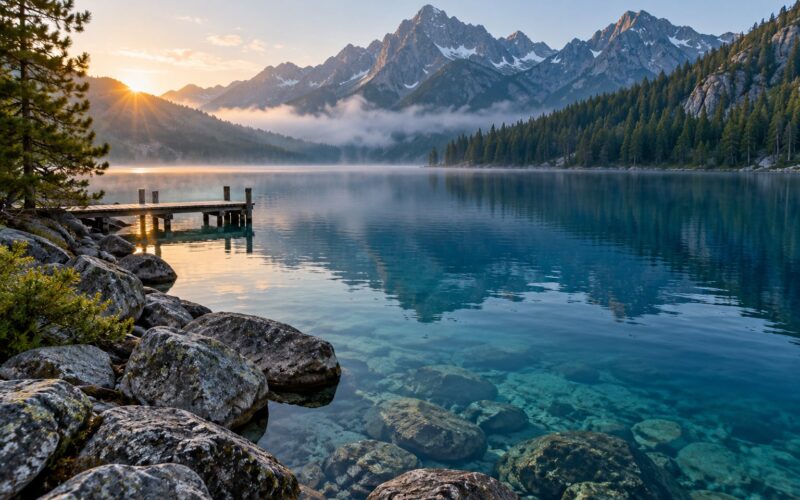
Cold water is denser than warm water, so as a lake warms from above, it sorts into layers. The warm top layer is the epilimnion. Below it sits the cooler, denser hypolimnion. Between them is a sharp boundary called the thermocline.
Wind and density differences stop the layers from mixing most of the summer. That is the process called thermal stratification, and it is why a reservoir can be 80°F and pleasant at the surface while the water twenty metres down sits near 50°F in the same afternoon.
What stratification does to fish and water quality
Fish are split by temperature preference. Warm-water species such as bass and crappie concentrate in the sunlit surface layer. Cold-water species such as trout and many char move deep into the hypolimnion, and anglers chasing them end up fishing cold, oxygen-rich water far from shore.
Oxygen follows the split too. The surface layer gets oxygen from wind and from photosynthesis. The deep layer gets none of either once mixing stops, and the bacteria breaking down trapped organic matter consume what dissolved oxygen is left. Deep reservoir water in late summer can hold only a fraction of what it held in spring.
Fish that are squeezed into the warm layer when deep oxygen falls get stressed first, and stressed fish lose condition and lose to disease. That is the plain mechanism behind fish kills, and it is why a warm, cloudy, low-flow summer is the dangerous combination rather than heat alone.
Twice a year, typically, the layers mix: once as spring warms the water toward one temperature, and again as autumn cools it. These turnovers re-oxygenate the whole basin at once. Spring turnover is why fisheries managers stock when they stock, because it is the window when the entire lake mixes nutrients and oxygen together.
Light behaves differently than heat. Clearer surface water lets sunlight reach deeper, warms more of the column, and feeds a longer growing season for plants. That longer season is another reason reservoir algae problems are often worse than in a turbid natural lake.
What Happens to Fish, Plants, and Other Lake Life
A dam is a wall to anything that swims. Species that migrate between a river and a lake system, and species that need to move upstream or downstream to reach spawning gravel, lose access to habitat they depend on.
Some fish pass upstream on their own during high flows, and some cross a dam through a bypass channel, a lift, or a fish passage built into or around the structure. Even good passages are selective. Species that are strong swimmers get through and species that are not do not, so passage designs are usually tailored to a specific target list.
Turbines and spillway drop structures kill fish outright. Fish that survive a fall through a turbine are frequently killed by pressure change, and fish passing over a spillway are often bruised or abraded. Downstream passage behaviour varies a lot from one structure to the next.
Habitat and populations shift
Upstream, flooding removes the riffles, side channels and floodplain features that juveniles depend on, replacing them with deeper, slower water. Species assemblages reorganize toward generalists that handle low flow and warm temperatures. The result is often fewer species but larger individuals, which is exactly what anglers notice about reservoir fishing compared with the river above it.
Plants respond too. Where sediment is shallow enough and water is clear enough, submerged vegetation grows far more aggressively than it did in the river, then spreads through shallow arms and bays. Aquatic weed overgrowth that worsens every year is one of the most common complaints from lake users and shoreline residents.
Algae respond to warmth plus nutrients. Longer warm seasons, slow turnover and retained phosphorus combine into the conditions behind the blue-green algae advisories that close swimming beaches. Cyanobacteria produce toxins, which is why health advisories rather than aesthetics are the real issue.
Everything above the waterline feels it too. Shoreline nesting birds lose the shallow mudflats that fluctuating levels and rising sediment bury. Emergent insects, the food base for juvenile fish, track the same shift in plants. Amphibians that breed in shallow, slowly changing water lose the wettest edge of the habitat, since that edge is now underwater at one stage of the season and dry rock at the next.
Not every reservoir behaves the same way. A shallow, wide, frequently drawn-down reservoir looks nothing like a deep, narrow, stable one, and a dam in a nutrient-poor mountain watershed will behave differently from one downstream of farmland.
Why the Downstream Ecosystem Is Also Affected
Below a dam, the river receives water on somebody else’s schedule, at a temperature somebody else chose, carrying a fraction of the sediment it used to carry. Three things change together, and it is hard to separate them.
Flow. Peak flows drop sharply, and low flows can rise when generation or irrigation releases increase. Floods no longer scour gravel bars or deposit silt on floodplains, so the channel often narrows, incises into its own bed, and loses its side channels. Some reaches shift toward coarse, rocky substrate that favours trout and riffle insects; others shift toward fine sediment that favours warm-water tolerant species.
Temperature. Water drawn from the hypolimnion leaves the dam cold even in July. Water drawn from the surface leaves warm. A release that runs cold during a heat wave can shock downstream fish and invertebrate populations, and an angler fishing a tailwater in August may be standing near 45°F water.
Sediment and nutrients. With the sediment supply cut off, the tailwater channel usually runs clear. Bank erosion downstream of the structure replaces channel scour as the main sediment source. Clear water is not automatically good, either: gravel that would have been replenished stays put, and the buried seeds and organic material that kept the floodplain alive no longer arrive.
Floodplain habitat is often the biggest downstream loss. Wetlands that were recharged and reworked on a schedule now receive a different, less seasonal pattern. Old oxbow lakes silt up faster because they lose the periodic scour that kept them open.
Not all of it is loss. Some dams have been retrofitted with minimum flow releases and temperature control structures. Those exist specifically to interrupt the worst of the downstream pattern.
Which Changes Come From the Dam and Which Come From People?
Most lake problems get blamed on the dam because the dam is visible and the diffuse sources are not. Being honest about causation makes the difference between a real diagnosis and a guess.
Other pressures land in the same reservoir at the same time. Agricultural and urban runoff deliver the bulk of the phosphorus in many watersheds. Water withdrawals can drop a pool low enough that shoreline habitat dries out. Shoreline development strips the vegetation buffer that used to filter runoff before it reached the lake.
Aquatic invasive species can reorganise a plant and fish community faster than the dam ever did. Wildfire sends ash and nutrients into a basin within days. And year-to-year weather swings, including drought and warmer summers, change stratification and mixing patterns independently of any operating decision.
A careful assessment separates them by comparing conditions over long stretches rather than one season, and by looking at the whole watershed rather than the pool alone. That is why a monitoring programme, public reservoir level records, and published water quality reports are worth more than any single site observation.
Within the dam’s own influence there is a useful dividing line. Conditions inside the pool are mostly dam effects. Conditions far downstream are mostly rainfall, snowpack and watershed use. The transition zone in between is genuinely mixed, and that is where most of the argument lives.
How to Observe Dam Impacts at a Lake
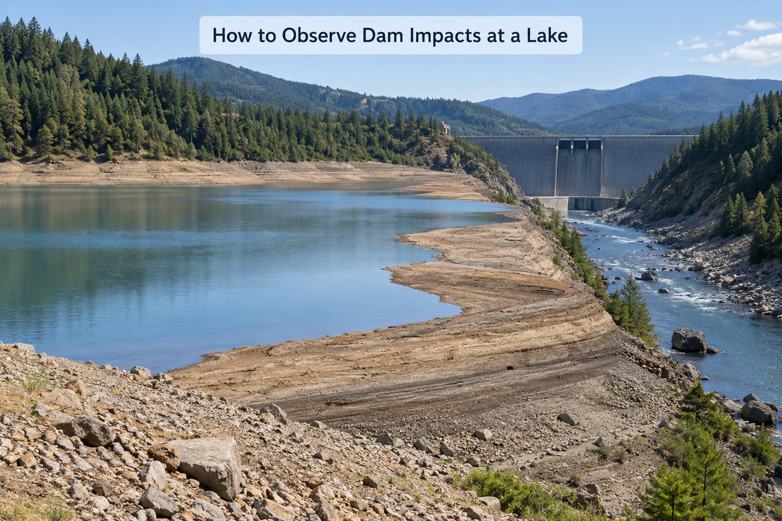
You do not need instruments to notice most of this. You need a reference point and a few habits.
Start with the operating record
Most dam operators publish current pool level, and often release rate, as public data. Note the pool level on the same date each visit, and check it against the previous year. A reservoir that is five feet lower than last summer is telling you something about inflow, withdrawals and management all at once.
Look at the shoreline and the waterline
Walk a familiar cove at low water and look at the exposed band above the current surface. An old, dark, stained zone well above the water shows the high-water mark and tells you how much the pool moves. Fresh sediment, dead stumps and undercut banks appear where drawdown has exposed material that used to be submerged.
Read the water at the outlet
Water released from a deep outlet often looks darker or slightly milky and feels noticeably cold. Water from a surface release matches the temperature of the surface. Comparing the two is a quick, honest lesson in what depth means, done safely from a public access point or bridge.
Watch the plants and the plankton
Beds of submerged vegetation reaching far into a shallow arm, a green cast on the surface in midsummer, and a shoreline band of dead or dying weed after a bloom are all visible without sampling. Record them with dates. Annual repeat visits turn impressions into a real record.
Use the data that already exists
State and provincial water quality agencies, tribal monitoring programmes, university extension offices and federal dam operators publish reservoir temperature profiles, fish population surveys and nutrient data for many major waters. Those baseline records show change far more clearly than a single visit will.
Keep a safe distance from the structure
Stay well clear of spillways, outlet works, gates, penstocks, stilling basins and any signed or fenced exclusion area. Releases can start with little warning, currents near outlet structures are far stronger than they look, and sudden level changes make shoreline edges unstable. Watch from public access areas and marked overlooks, keep the boat off the dam face, and follow posted advisories without exception.
Frequently Asked Questions
Do dams always make a lake ecosystem worse?
No. Dams provide flood control, water storage, hydropower, irrigation and recreation, and some systems manage levels and temperature deliberately to protect habitat. The ecological result depends on the structure, its operation, the watershed and how long it has been in place. Some impacts, like blocked migration, are essentially permanent. Others, like sediment accumulation, can be slowed by good management. Judge a dam case by case rather than as a category.
Why can dams cause algae to grow more often?
A reservoir stops transporting sediment and nutrients downstream and keeps them instead. Slower water, clearer surface layers from settling silt, a longer warm growing season and trapped phosphorus all help algae. Warm surface water sits above cool deep water for most of the summer, and algae thrive in that warm layer. In older reservoirs the accumulation of nutrients and organic sediment makes blooms more likely each year than in a young one.
How does a dam affect fish migration?
A dam is a barrier, so fish cannot reach upstream spawning, nursery or feeding areas on their own. Species that need to move between river and reservoir systems lose access to habitat, which fragments populations. Some cross during high flows, some use a bypass channel, lift or fish passage, and some are stocked into the upper basin instead. Passage structures help, but they are usually built for a target list of species rather than for everything.
Does water released from a dam have a different temperature?
It can. Where the outlet takes water from determines the temperature. Low-level outlets draw cool bottom water, so releases can stay cold well into summer, while surface outlets release water close to the current surface temperature. A cold release shocks downstream fish and insects, and a warm one can raise reach temperatures enough to affect habitat. Dam operators do regulate temperature at some structures for exactly this reason.
Why can’t you swim near a dam?
Currents near dams, gates and spillways are much stronger than they look, and releases can begin with little warning. Rapid level changes leave shorelines and reservoir edges unstable and can pull debris into the water. Turbine intakes and outlet works are hazardous in ways that are not visible from above. Posted exclusion zones exist for a reason. Swim away from the structure and from the downstream tailwater reach entirely.
What happens to sediment behind a dam?
Slowing the water makes it drop its load. Coarse gravel and sand build a delta near the dam, finer silt settles through the basin, and organic ooze accumulates in the deepest areas. Over decades this reduces storage capacity so the same pool holds less water each year. Trapped nutrients go with the sediment, which feeds the algal problems and internal loading that show up in older reservoirs.
What to Look For First at a Dammed Lake
Start with the dam’s role, because everything else depends on it. A water supply dam, a flood control dam and a hydropower dam move water differently, and their tailwaters behave differently for that reason.
Then compare across five things: how the pool level changes through the year, how temperature is layered above and below the thermocline, where sediment and weeds have accumulated, what the vegetation and plankton look like at the same time each year, and how clear or cold the release is below the structure.
Two seasons of notes on the same date, at the same access point, will show you more than any single afternoon of guessing. Pull the public pool level and release data for the same dates and put your observations next to it. That is the whole method.