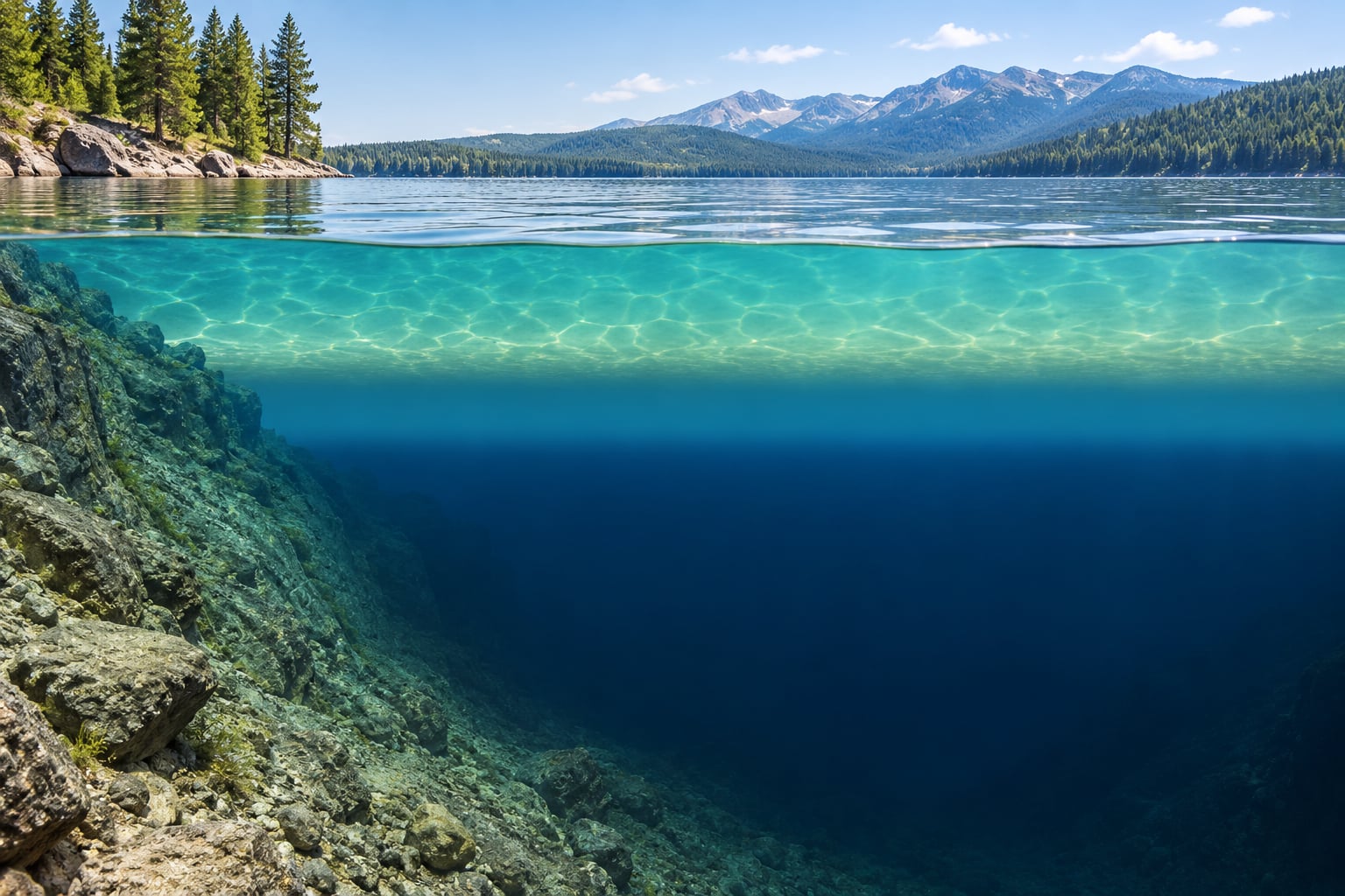
If you have ever wondered why a lake thermocline matters, the short version is this: sun-warmed surface water floats on top of colder, denser water, and the boundary between them becomes a thin band where temperature plunges with depth. Understanding how thermocline works in a lake is really about understanding why a lake splits into layers at all.
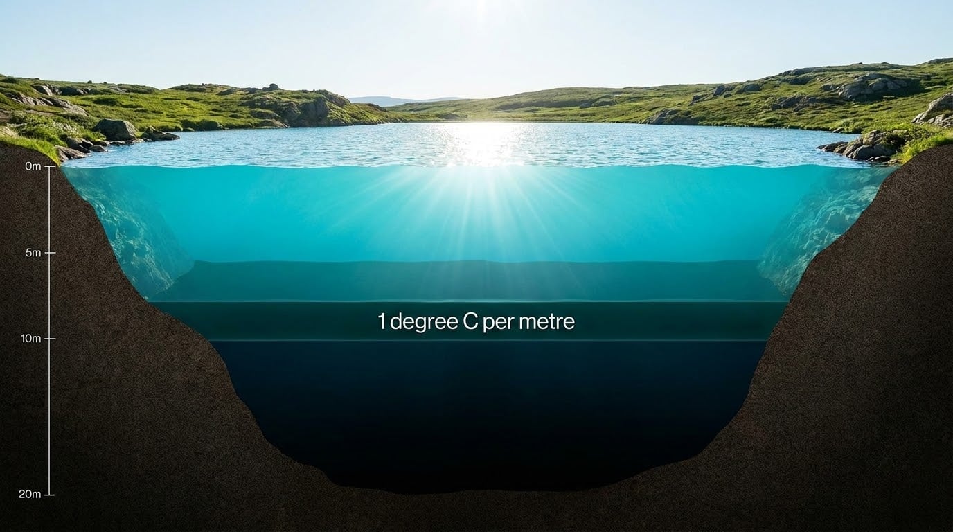
A thermocline is defined as a layer across which water temperature drops by at least 1 degree Celsius per metre of depth. In the clearest lakes that drop happens inside a band only a few metres thick, while the water above and below barely changes across tens of metres. That single sharp gradient is the whole reason the rest of the lake behaves the way it does in midsummer.
Below this guide you will find the three named layers, the physics that builds them, the depth numbers, what happens to oxygen, how to locate the layer yourself, and what a thermocline means for anyone on the water in July.
Table of Contents
- 1What a lake thermocline actually is
- 2The three layers of a stratified lake
- 3Why the thermocline forms: heat, density and wind
- 4How deep is a lake thermocline?
- 5Dissolved oxygen above and below the thermocline
- 6How the thermocline changes through the year
- 7Spring turnover
- 8Summer stratification
- 9Fall turnover
- 10How to find the thermocline yourself
- 11What the lake thermocline means for fishing and boating
- 12Which species sit where
- 13Shallow lakes versus deep lakes
- 14A note for boaters
- 15Frequently Asked Questions
- 16How deep does a lake need to be to have a thermocline?
- 17What are the three layers of a lake?
- 18Is there oxygen below the thermocline?
- 19Do you fish above or below the thermocline?
- 20Are thermoclines permanent?
- 21How thick is a thermocline in a typical lake?
- 22How do I find the thermocline on a fish finder?
- 23Conclusion
What a lake thermocline actually is
Stratification is not a single layer sitting in one place. A stratified lake is really three layers stacked on top of each other, and the middle one is the one everyone calls the thermocline.
Two things are happening at once. Heat from the sun goes into the top few metres, and wind keeps stirring only those top few metres. Everything below that churned surface sits still, and the water there neither warms nor cools much until the season turns.
The practical test is the gradient itself. If you drop a thermometer down and it reads 24 degrees at 2 metres, 22 at 4 metres, then 18 at 6 metres and 8 at 8 metres, the fast drop between 4 and 6 metres is your thermocline. The 1 degree Celsius per metre rule of thumb is where most lake scientists draw the line, and it is stricter than the loose “a few feet” descriptions you will see in fishing magazines.
The three layers of a stratified lake
Limnology, the study of inland waters, has standard names for all three layers. Anglers rarely use them, but knowing them makes every other explanation on this page easier to follow.
| Layer | Typical depth | Temperature | Dissolved oxygen | Light | What lives there |
|---|---|---|---|---|---|
| Epilimnion (surface layer) | Surface to roughly 3 to 8 metres | Warm, changes daily with weather | High, replenished by wind and rain | Bright, supports photosynthesis | Bass, pike, panfish, plankton, weed beds |
| Metalimnion (thermocline) | A band of about 1 to 3 metres | Drops at least 1 degree Celsius per metre | Falls off sharply through the band | Dim, fading fast | Bacteria, insects, baitfish hugging structure |
| Hypolimnion (deep water or cold-water pool) | Bottom of the lake | Cold, near 4 degrees Celsius, very stable | Low, often near zero by late summer | Dark | Cool-water fish such as walleye and some trout |
The epilimnion is the mixed layer, churned by wind every time it blows. The metalimnion is the thermocline proper, and it is thin enough that anglers talk about it as a line or a break rather than a layer. The hypolimnion below never mixes with the surface until turnover.
Why the thermocline forms: heat, density and wind
Water has an unusual quirk that makes lake layering possible. It is densest at about 4 degrees Celsius, not at its coldest.
That single fact is why a lake can flip its layers twice a year. Sun does the heating, wind does the stirring, and the two only ever work the top layer. Once autumn nights cool the surface below the density of the water beneath it, the top water sinks and the whole column mixes.
Solar radiation heats the surface water first, and that water expands and becomes less dense, so it floats. The deeper water stays cold and heavy underneath it. Day after day through early summer the warm cap thickens, while the boundary between it and the cold water below gets squeezed tighter.
Wind is the other half of the mechanism, and it is the reason a windy July looks so different from a calm one. Wind-driven mixing only works on the surface layer, so its job is to deepen the epilimnion and push the thermocline down. A week of steady wind can drive that break a couple of metres deeper, which is enough to move every fish-holding structure in the lake with it.
Gas solubility matters as well. Cold water holds more dissolved oxygen than warm water, so the deep layer starts summer with a decent supply and then burns through it, while the surface layer keeps getting topped up from the air.
How deep is a lake thermocline?
Most lakes need to be deeper than about 10 to 12 metres for a thermocline to hold reliably through summer. Below roughly 8 metres there is often not enough cold water to keep a distinct layer, and on many shallow lakes the whole column mixes and warms together all summer instead.
These shallow waters are called polymictic, meaning they mix repeatedly. Lakes that reliably stratify are called dimictic, mixing twice a year. That is the practical answer for anglers: on a six-metre pond you will never find a thermocline, and on a fifteen-metre lake you will find one every summer in July and August.
Where it sits in a typical temperate lake in late July, and how fast the temperature falls through it:
| Depth | Temperature | Layer | Note |
|---|---|---|---|
| 0 m | 24 C | Epilimnion | Surface, warmest water |
| 2 m | 23 C | Epilimnion | Mixed by wind and waves |
| 4 m | 22 C | Epilimnion | Bottom of the warm cap |
| 5 m | 18 C | Metalimnion | Sharp break begins |
| 6 m | 12 C | Metalimnion | About 1 degree per metre and more |
| 7 m | 8 C | Metalimnion | Break ends |
| 10 m | 6 C | Hypolimnion | Cold, still, low oxygen |
| 18 m | 4 C | Hypolimnion | Bottom, densest water |
In imperial units for North American lakes, expect the summer thermocline somewhere between 15 and 40 feet down on a mid-size lake. The Hooked Ontario fishing write-up describes a typical temperate lake thermocline as five to eight feet thick, which lines up with the table above.
Dissolved oxygen above and below the thermocline
There is usually plenty of oxygen above the thermocline and very little below it, especially in a productive lake by August.
The cause is simple and slightly one-sided. Plants and algae in the sunlit epilimnion release oxygen during photosynthesis, and wind mixes that oxygen down through the top layer. Below the metalimnion there is no light left for photosynthesis, so the only thing happening down there is respiration. Bacteria, fish and sinking organic matter all consume oxygen and release carbon dioxide as they break down.
The thermocline acts as a lid. Density stops the layers mixing, so the oxygen below is used up and never replaced from the surface. By late summer the hypolimnion of a eutrophic, weed-choked lake can be functionally anoxic, which is the oxygen sag curve limnologists use to describe that pattern.
That is why structure crossing the layer matters. Fish gather at the top of the thermocline, just below the last oxygen-rich water, where they get the cold they want without suffocating. Angler reports on Wayne’s Words describe consistent catches right on the thermocline through the whole stratified season, and Hooked Ontario makes the same point about weed beds and rock bars that intersect it.
How the thermocline changes through the year
Thermoclines are seasonal, not permanent. In a temperate lake the layer appears in late spring, strengthens through July and August, and is erased in autumn.
Spring turnover
Ice melts, the surface water chills toward 4 degrees Celsius, becomes denser and sinks. Wind stirs the column until the lake is mixed top to bottom at close to one temperature. This is spring turnover, and it is the best fishing of the year in most northern lakes because oxygen and nutrients are carried through the whole water column.
Summer stratification
Once the surface water heats past the density of the water below, mixing stops. The thermocline sets between about 5 and 15 metres, deepens a little through July, then holds. Fish follow it, and the deep layer quietly loses its oxygen.
Fall turnover
As nights cool in September and October, the surface water cools, gains density and sinks. Wind drives the whole column into one temperature again, which is fall turnover. Warm surface water sinks to the bottom, oxygen-rich surface water moves down, and the fish that spent the summer deep disperse into the entire lake. Walleye Central forum discussion describes warm-water walleye holding tight below the thermocline in July and fishing picking up sharply once that layer breaks down.
How to find the thermocline yourself
You do not need a research budget. Most anglers can locate the layer in a few minutes with gear they already own.
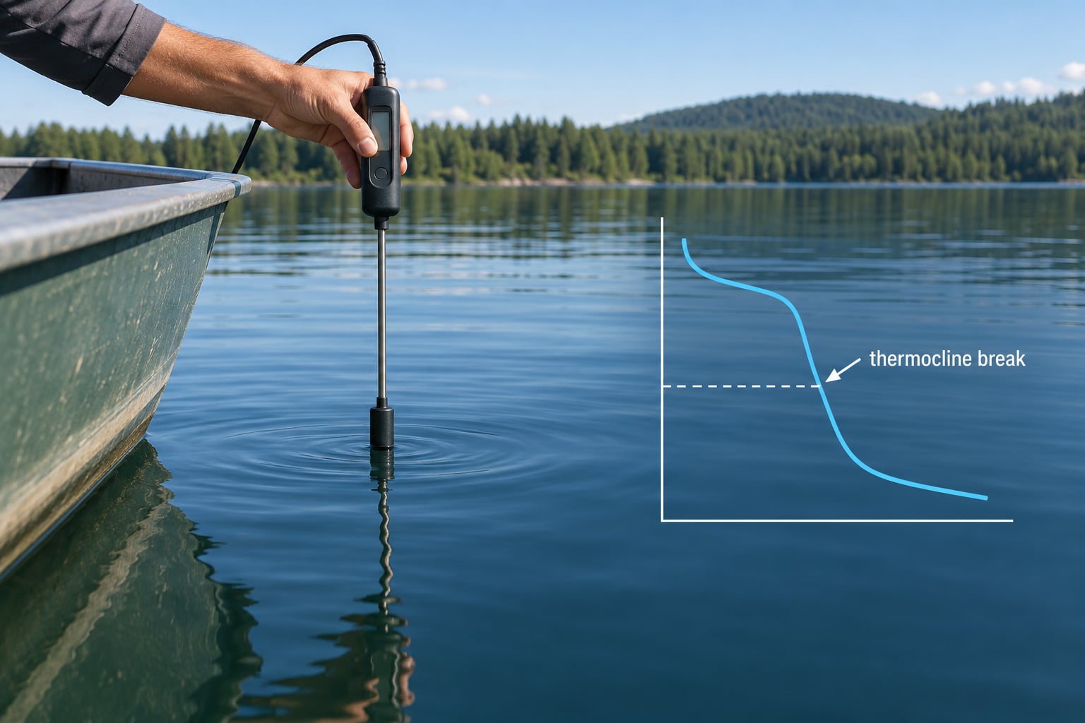
- Drop a probe. A cheap digital thermometer on a marked line, or a temperature probe built into your fish finder, gives you a temperature every metre. Note where the reading changes fastest.
- Use your depth sounder. Most units draw temperature beside each contour. Look for the depth where the numbers fall away sharply rather than stepping down gradually.
- Read the colours, not the arcs. On colour sonar, the epilimnion often reads one colour and the hypolimnion a colder colour, with a thin band between them. That band is the thermocline. Ignore the fish arcs and follow the colour change with depth.
- Mark the structure, not the depth. Once you know the depth of the break, find the drop-offs and weed edges that cross it. That is where the fish will be.
- Re-check after a front moves through. Two or three windy days will push the thermocline down several metres and the fish with it. This is the point that catches people out in late July.
For a purely manual measurement, the classic tool is a bathythermograph, a weighted hinged case that records temperature on a chart as it is raised and lowered. Sciencing has a good step-by-step on that method if you want the full historical version.
What the lake thermocline means for fishing and boating
For anglers, the thermocline compresses the whole lake into a narrow band of productive water. Fish that chase cool water sit right at it; fish that need oxygen cannot cross below it.
Which species sit where
Walleye and pike push deep through midsummer and hold on or just below the break, even when that means thinner air in the water. Bass, perch and panfish usually stay above or on top of it, working the weed edge where the warm cap meets the cooler layer. Trout and salmon in a kokanee lake track a different cold-water band, the spring-fed cold-water pool, which often sits well below the thermocline and can be near 4 degrees Celsius all summer.
That is also the usual answer to why fish seem to vanish in July. They have not left. They have all moved to the one layer that satisfies their temperature and oxygen requirements at the same time, and that layer can be five metres from where you are fishing.
Shallow lakes versus deep lakes
On a shallow lake the whole column warms together and no real thermocline forms, so fish spread across the basin and you can fish anywhere. On a deep lake the fish concentrate into a predictable band, and finding that band is the entire game. Deep is not automatically better fishing, but it is far more predictable fishing.
A note for boaters
The same sharp density change that fish use to hold position can confuse a depth sounder, which is why many anglers read false bottom or lose the bottom in that band. Slow down and give it a moment to settle. And if you are trolling near the thermocline in a boat with a through-hull or inboard propeller, some anglers report fouling or alarms when the cold layer hits the intake, so running shallower or watching your depth sounder there is not a bad habit.
Frequently Asked Questions
How deep does a lake need to be to have a thermocline?
A lake usually needs to be deeper than about 10 to 12 metres for a thermocline to hold all summer. Below roughly 8 metres there is often not enough cold water to keep a distinct layer, and the whole column warms and mixes together instead. Those shallow waters are called polymictic. Lakes that reliably stratify are dimictic, mixing twice a year in spring and autumn.
What are the three layers of a lake?
The epilimnion is the warm, wind-mixed surface layer. The metalimnion is the thermocline, a thin band where temperature drops at least 1 degree Celsius per metre of depth. The hypolimnion is the cold, still deep water below, often near 4 degrees Celsius. In a stratified lake the three stack in that order from the surface to the bottom.
Is there oxygen below the thermocline?
Usually very little by late summer. Cold deep water starts the season with dissolved oxygen, but there is no light below the thermocline for photosynthesis, so bacteria, fish and sinking organic matter respire and use it up. The thermocline blocks mixing with the surface, so nothing replaces that oxygen. In productive lakes the deep layer can become functionally anoxic by August.
Do you fish above or below the thermocline?
Most warm-water species sit on or just above the break, where the water is cool enough but still holds oxygen. Walleye and pike commonly hold on or just below it, tolerating thinner oxygen to reach colder water. Find the depth of the break on your electronics, then work the drop-offs and weed edges that cross that depth.
Are thermoclines permanent?
No. They are a seasonal feature of temperate lakes. The thermocline sets in late spring once the surface water is warm and light enough to stop mixing, strengthens through July and August, then disappears at fall turnover when the surface water cools, gains density and sinks, mixing the column top to bottom. Shallow ponds may never form one at all.
How thick is a thermocline in a typical lake?
In a temperate North American lake the break is usually about 1 to 3 metres thick, and fishing writers often quote five to eight feet as a rule of thumb. The key is not the thickness but the rate of change: temperature falls by at least 1 degree Celsius per metre of depth through the metalimnion, while the layers above and below barely change.
How do I find the thermocline on a fish finder?
Look at the temperature readout beside each contour, not the fish arcs. The numbers fall away sharply at the thermocline and then level out again in the cold bottom water. On colour sonar you often see the same break as a thin colour band between the warm surface colour and the colder deep colour. Expect to re-check it after a few windy days push it deeper.
Conclusion
Start on the water with one task: find the depth where your temperature readout falls away, then locate structure crossing that depth. Everything else in a summer lake follows from that line. Check it again after every stretch of windy weather, because the lake thermocline moves more in July than most anglers expect.