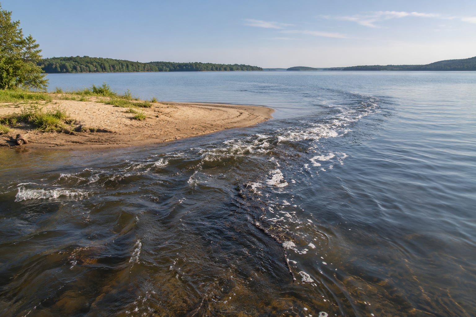
A rip current in a large lake is a surface flow of water moving away from shore, usually funnelled through a gap in a sandbar, beside a pier, or near a creek mouth. On a lake there are rarely breaking waves to give it away, so you look for water that travels seaward while the water around it does not, and for foam, weeds and debris moving in the same direction.
It takes about ten minutes of walking the shoreline to read a lake properly, and it is the difference between a good swim and a bad one. The method below works on a flat, windless morning as well as it does on a choppy afternoon, which is why it is different from most beach advice.
Table of Contents
- 1What You Need
- 2Step-by-Step: How to Spot a Rip Current in a Large Lake
- 31. Check the lake and weather conditions
- 42. Look for water moving away from shore
- 53. Identify the locations where currents are most likely
- 64. Watch for human-made and natural warning signs
- 75. Test the observation before entering the water
- 86. Keep swimmers and boaters out of suspected currents
- 9Common Mistakes
- 10Frequently Asked Questions
- 11Can you get a rip current in a lake?
- 12What are the 5 signs of a rip current in a lake?
- 13Do any currents pull you under?
- 14Is it possible to swim out of a rip current?
- 15How do I spot a current on a calm lake with no breaking waves?
- 16How far should you stay from a pier on a lake?
- 17Conclusion
What You Need
You do not need equipment. You need three minutes of information and a fixed point to look back at.
- The current forecast. The National Weather Service publishes rip current risk for ocean beaches and for the Great Lakes shoreline. Check it before you drive, and treat anything above moderate as a reason to pick a different beach or a different day.
- Local lake notices. The park district, harbour authority or marina usually knows about dam releases, culvert flow, high water and temporary buoys. A quick call is worth more than any app.
- A fixed reference. A pier post, a jetty, a buoy or a distinct rock. Stand where you can see it, look at the water in front of it, then walk 30 metres along the shore and look back. Water that has shifted or smoothed tells you something is moving.
- A plan for the least confident swimmer. Everyone agrees on the swim spot before anyone gets wet. Pick for the weakest swimmer, not for the strongest.
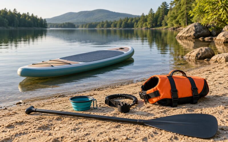
- Proper flotation. A worn, well-fitting life jacket for every child on shore and every paddler on the water. A current plus cold water plus no flotation is the combination that turns a swim into a rescue.
Step-by-Step: How to Spot a Rip Current in a Large Lake
1. Check the lake and weather conditions
Wind and fetch decide where the energy goes. Water driven toward shore has to return somehow, and it returns fastest where the bottom channels it. When a strong onshore wind has blown across a long stretch of open water for a few hours, expect that return flow to concentrate at points, bars and structures.
Also check what changed recently. Rain upstream, a dam releasing, a spillway running, or a lake several centimetres above normal all add outflow that did not exist the day before. NOAA notes that rip current risk climbs after storms and during high-water periods, and the same logic applies inland.
2. Look for water moving away from shore
This is the clue that carries the whole method, because it works with or without waves. Ordinary wave action runs toward you and then returns in the same lane. A current runs away from you, continuously, in one direction.
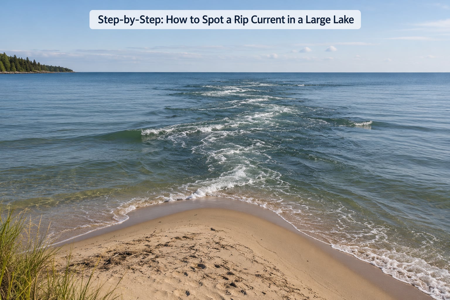
What it looks like from the bank: the water surface is darker and smoother than its surroundings, or rougher and choppier, depending on the bottom. A ragged line of foam sits offshore and drifts out. Seaweed, sticks and floating junk pass through that lane and head away from land. The waterline behind you keeps sliding down the beach as new water arrives, even though no waves are arriving.
Give it time. Watch a fixed point for a full minute. If the water in that lane is heading out the whole time, it is a current, not a wave running back.
3. Identify the locations where currents are most likely
You do not have to search the whole shoreline. Currents concentrate in a handful of predictable places on any lake.
- Points, headlands and rock outcrops. The classic. A headland splits the flow and the returning water concentrates directly off its tip.
- River mouths, creek outlets, culverts and spillways. The outflow is already aimed away from shore, and the channel shape keeps it that way.
- Piers, jetties and groynes. Solid structures stop the alongshore flow and force it seaward beside them.
- Narrows and channels between coves. Water accelerating through a gap carries its speed straight out past the beach.
- Dam and weir outlets. Obvious outflow, and it can be strong enough to hold a paddler.
- Drop-offs and sudden depth changes. The surface often looks calm over deep water right where a shallow shelf ends.
4. Watch for human-made and natural warning signs
Structures leave clues. Water flowing beside a pier often looks sheltered and flat, which is exactly why it surprises people. A line of foam, a scum line, or floating debris that stops at one point and then streams away from the structure is a current, not a boundary.
Watch the wave pattern. Waves arriving every four to eight seconds and hitting the same spot tell you where a current is not. A lane where the water never breaks, or where the chop runs the wrong way against the wind, is a lane worth avoiding.
And remember the trap: smooth, glassy, inviting water on a lake is not evidence of safety. It may simply mean the wind is off the water entirely.
5. Test the observation before entering the water
One clue is a guess. Two independent clues are worth taking seriously.
Count them. Outward-moving foam plus a smoother or darker lane. A seam of debris plus a spot where the waterline creeps away from your feet. Two of those together and you move to a different entry point.
If you are still unsure, ask someone who knows that stretch of water. A lifeguard, marina attendant, park ranger, harbour master or fishing charter captain sees currents change with the season and will tell you in ten seconds what you might spend half an hour missing. If nobody local is available, staying out is the honest call.
6. Keep swimmers and boaters out of suspected currents
Prevention is a decision made in sandals on the beach, not in the water.
- Choose an entry point with an even, continuous waterline and no debris streaming out of it.
- Stay well clear of piers and docks. National Weather Service Great Lakes guidance is to steer clear of piers entirely; treat roughly 100 yards as a conservative buffer, and much more in wind or following a storm.
- Keep children in arm’s reach in the shallows, and out of the water entirely when a current is suspected.
- Wear a life jacket on any boat, kayak or paddleboard. A current that you cannot swim against is an ordinary afternoon for a paddler in a boat and an emergency for the same person in open water.
- Never swim into a current to demonstrate where it is or to retrieve something.
Common Mistakes
Mistaking a smooth channel for calm water. On an ocean beach, darker smoother water is a warning because it is surrounded by whitewater. On a lake there may be no whitewater anywhere, and the smooth lane is the current. Watch direction, not appearance.
Assuming only ocean beaches have rip currents. The National Hurricane Center and the National Weather Service both treat the Great Lakes as rip current environments, and inland currents also come from structures, outlets and drop-offs that have no ocean equivalent.
Believing a rip current will pull you under. A rip is a horizontal surface flow. It does not suck you down. What kills people is fighting a current until they are exhausted, panicking in cold water, or trying to swim straight back to shore against it.
Ignoring local warnings because the beach looks empty. A posted flag, a double-red flag or a closure means somebody has already measured what you are trying to eyeball. There is no beach patrol at most lake beaches, which is exactly why you are the one doing the scan.
Treating floating debris as a reliable marker. Debris tells you a current exists. It does not tell you its strength or how wide it is. Two clues minimum.
Frequently Asked Questions
Can you get a rip current in a lake?
Yes. Large lakes produce the same kind of surface outflow as ocean surf beaches, usually through a gap in a sandbar, beside a pier, off a point, or near a creek mouth. Lakes also have hazards the ocean does not: structural currents beside docks, outflow at dam and spillway outlets, and currents through narrows and coves. Cold water makes all of them more dangerous than people expect.
What are the 5 signs of a rip current in a lake?
1. A lane of water travelling away from shore while the water beside it does not. 2. A gap or smoother, darker patch in the water surface. 3. Foam, bubbles, seaweed or debris moving seaward. 4. Churning or choppy water with a defined line at its edge. 5. A waterline that keeps sliding away from your feet with no waves arriving. Two of the five together should send you to a different entry point.
Do any currents pull you under?
Not a rip current. A rip is a horizontal flow at the surface, not a downward pull, and it does not hold you under once you stop swimming against it. People who drown in rips usually drown because they fought the current, ran out of energy, panicked, or suffered cold water shock. A separate hazard, cold water shock, can cause gasping and loss of control in the first minute of immersion in northern lakes.
Is it possible to swim out of a rip current?
Usually, yes, and you do it by giving up the fight. Float on your back with your feet pointing downstream, raise an arm so people can see you, then swim parallel to shore or at an angle away from the current until you are out of it, and only then head in. Swimming straight at the shore is what exhausts people. If you are near a jetty or a boat, work toward that structure instead of the beach.
How do I spot a current on a calm lake with no breaking waves?
Stop waiting for waves to give it away. Watch debris, foam and weed for one full minute and see which direction they travel. Compare a patch of water against the water beside it: different colour, different texture, or a flat lane through wind dimples all count. Then walk 30 metres along the shore and look back from a fixed landmark. Any water that smoothed, darkened or started flowing out is where the current is.
How far should you stay from a pier on a lake?
National Weather Service Great Lakes guidance is to steer clear of piers completely rather than measuring a safe distance, because the flow beside a structure is strong and unpredictable. If you must swim near one, 100 yards is a conservative buffer, and you should increase it when the wind has been onshore for a day or a storm has just passed. The same buffer logic applies to jetties, groynes and boat ramps.
Conclusion
Start with the forecast and the local notices, then walk the shoreline and watch one patch of water for a full minute. If foam, weed and the waterline are all moving away from shore, you are looking at a current, and the answer is a different swim spot, not a deeper one.
Two independent clues are your threshold. One clue is a guess. Nobody needs to be a strong swimmer to spot a rip current, and the people who get into trouble are usually the ones who assumed calm water was calm because it looked it.